Cartography in the 21st century: from a round globe to a flat map
Distorted representation of countries on online maps
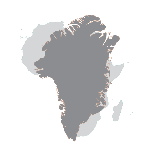
Greenland & Africa on online maps…
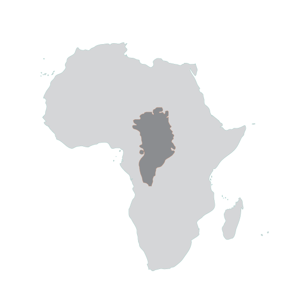
… but in reality
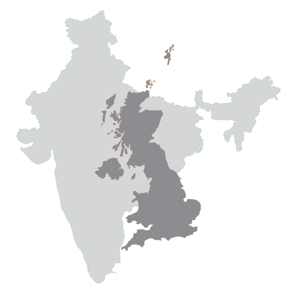
India & the UK on online maps…
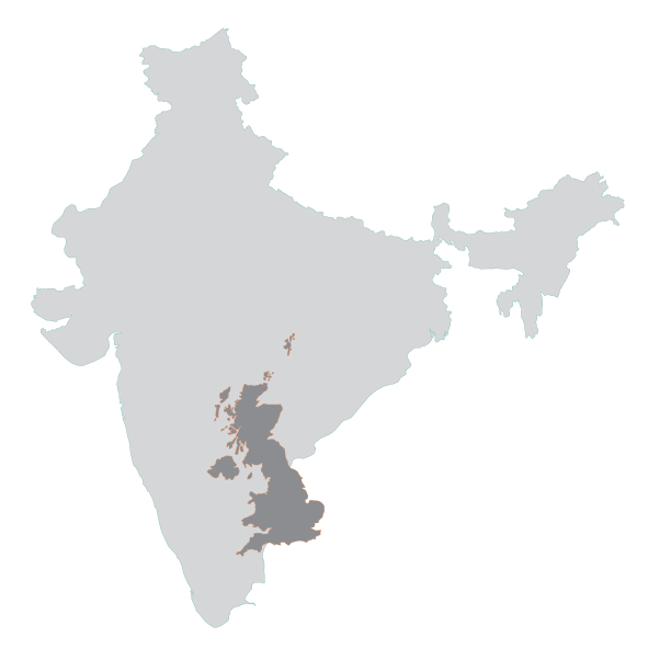
… but in reality
How accurate is your mental map?
What?
To project a round world on a flat map is a challenge. Throughout history many cartographers developed formulas and projections to solve this problem. However, a map without distortions does not exist. There are countless discussions on which map projection to use in our education systems, online and on the (social) media. Even today some controversial projections are still very much in use, such as the Mercator projection (e.g. OpenStreetMap), that was meant for navigational purposes and can be considered to be a Eurocentric projection as it enlarges the areas towards the poles (such as Europe and North America).
Do these distortions and map projections have an influence on our worldview and on our mental maps: the representation of the world that we have in our mind?
More information: https://www.youtube.com/watch?v=kIID5FDi2JQ
Who?
Everyone is welcome to participate!
Do you know a teacher who wants to join with his or her students, a company with its employees, an institution with its researchers or friends and family who want to know more about their world view?
The tool can easily be used in the classroom to introduce the subject of cartography, map projections, worldview or even the possible manipulation of information.
How?
Feel free to check your view of the world by testing your knowledge about the size of countries and continents.
Compare 10 pairs of countries and continents in 5 minutes on a computer, tablet or smartphone.
keyboard_arrow_rightwww.maps.ugent.be